Channel Islands and Santa Barbara
Channel Islands and Santa Barbara
We flew into Santa Barbara on a Saturday, picked up a rental car, and drove straight down to Ventura. No sightseeing, no detours. We had a boat to catch the next morning and a list of things we still needed.
First stop was an REI for fuel canisters for the Jetboil and a pile of freeze dried food. You can’t fly with fuel, and there are no stores on the island, so that one errand was necessary to have meals and coffee. Then we checked into a hotel near Ventura Harbor and walked over to the national park visitor center before it got dark.
That visitor center is worth the walk even if you’re only killing an hour. Channel Islands got its start back in 1938, when Franklin Roosevelt set aside Anacapa and Santa Barbara Islands as a national monument. It stayed that way for decades. Not until March 5, 1980 did Congress fold in Santa Cruz, Santa Rosa, and San Miguel and make the whole thing the country’s fortieth national park. People had been going out there a lot longer than that, of course. Juan Rodríguez Cabrillo sailed past in 1542 and traded beads and cloth with Chumash men who paddled out to meet him, and the Chumash had already been living on those islands for something like 13,000 years by then.
We went to bed early because of the jet lag.
The Crossing
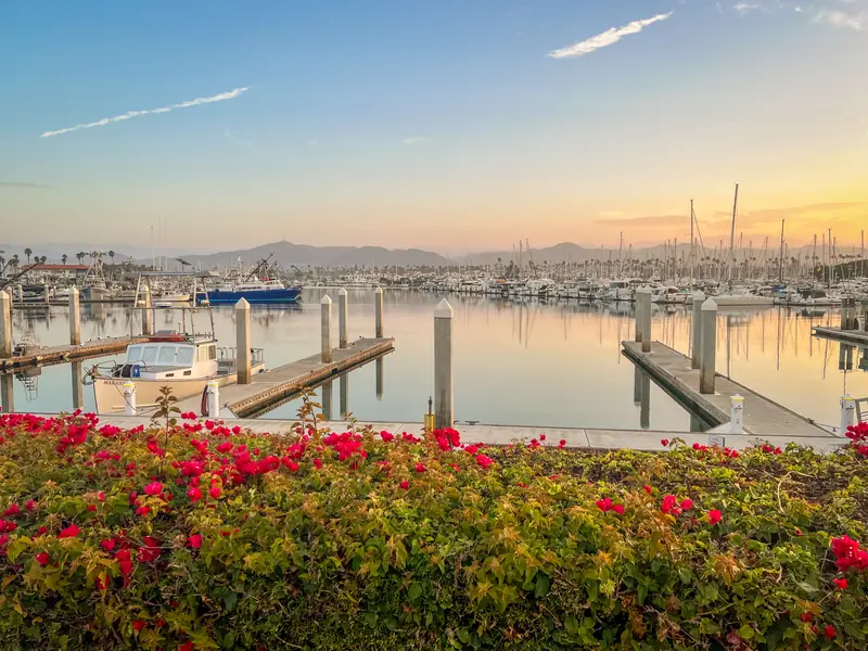 Walking to the Ferry in Ventura Harbor
Next morning we packed every piece of camping gear we owned and hauled it down to Island Packers. They’re the only outfit authorized to run people out to the park, and they’ve been doing it since 1968, when a design engineer named Bill Connally bought a converted World War II navy launch and christened it the Island Packer on Mother’s Day. Early trips out to Anacapa cost seven dollars and fifty cents. The family still runs the company.
The ride was rough. There was a big swell running and the boat came off the water more than once. Real air, then a slap, then spray coming over everybody. It was windy on top of that, so the spray went sideways. I spent most of the hour holding onto a rail and laughing at how wet we were getting. Nobody around us seemed too bothered, which helped.
We got to the island around ten in the morning, hauled our packs off the pier, and hiked up to the campground to set up.
Scorpion Ranch
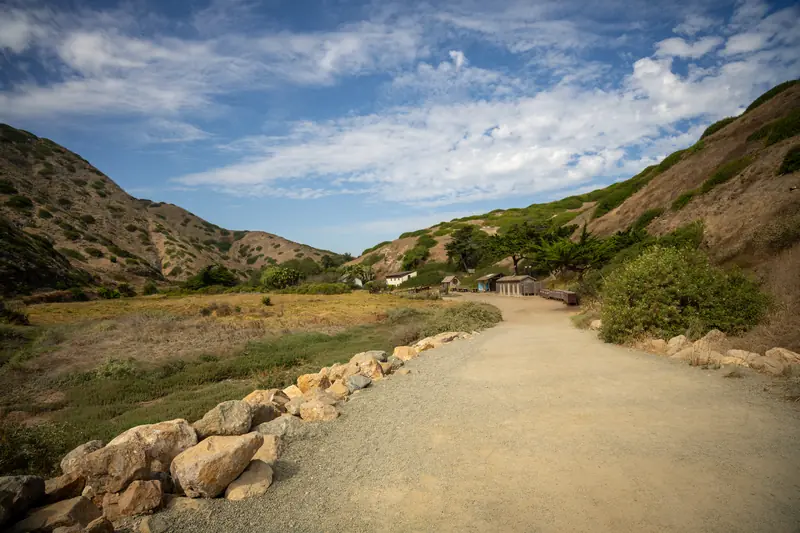 Walking into Scorpion Ranch on Santa Cruz Island
The walk in from the pier takes you right through the old ranch complex, and it’s one of those places where the history is just sitting out in the open. There are farm implements rusting in the grass, a blacksmith shop, a windmill, and a ranch house that now serves as the island’s visitor center.
Santa Cruz is the largest island in California, and its ownership history is a soap opera. In 1869 ten San Francisco businessmen formed the Santa Cruz Island Company and bought the place from William Barron. By 1880 one of them, a French immigrant named Justinian Caire, had bought out everyone else and owned the whole island himself. He turned it into a genuinely impressive operation, running thousands of sheep and building a winery, a chapel, and a blacksmith shop in the central valley. He kept European honeybees to pollinate his vineyards.
Then Caire died, and his will split the island between his heirs, and the family spent the next several decades in court. In 1925 a judge finally partitioned it. The eastern tenth, which is exactly where we were standing, went to his descendants the Gherinis, who kept running sheep here until 1984. The National Park Service bought out most of the family’s interests in 1994 and picked up the last piece in 1997. So the ground under Scorpion Ranch has only been fully public for about thirty years.
Go back further and this was one of the largest Chumash villages in the whole island chain. Santa Cruz was where they quarried the material for shell bead money, which circulated as currency all along the mainland coast. Eleven villages on this island alone when the Spanish showed up.
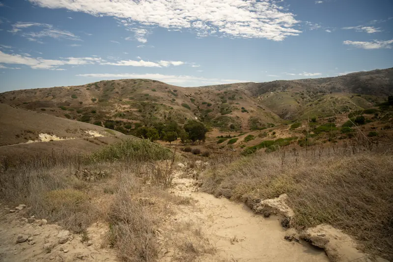 Looking down on the Upper Campground from a trail
The campground sits up a canyon about a half mile in, tucked into a grove of eucalyptus with ridges rising on both sides. Picnic table, food box, pit toilet, water. That’s the whole list of amenities and it’s more than enough.
Hiking the East End
Decided to make lunch before heading out on a hike, and the Jetboil wouldn’t light. Click, click, click, nothing. We took it apart, put it back together, checked the fuel, and clicked it another forty times. I was about ten seconds from giving up and eating a cold bar when we finally looked closely at the piezo igniter and saw that the little electrode arm was bent over and resting against the metal base. The spark is supposed to jump a gap to the burner head, and instead it was just grounding out against the body of the stove. We bent the arm back into shape with a fingernail, clicked it once, and it lit immediately.
Relieved and not as hungry, we set out walking, and then basically didn’t stop.
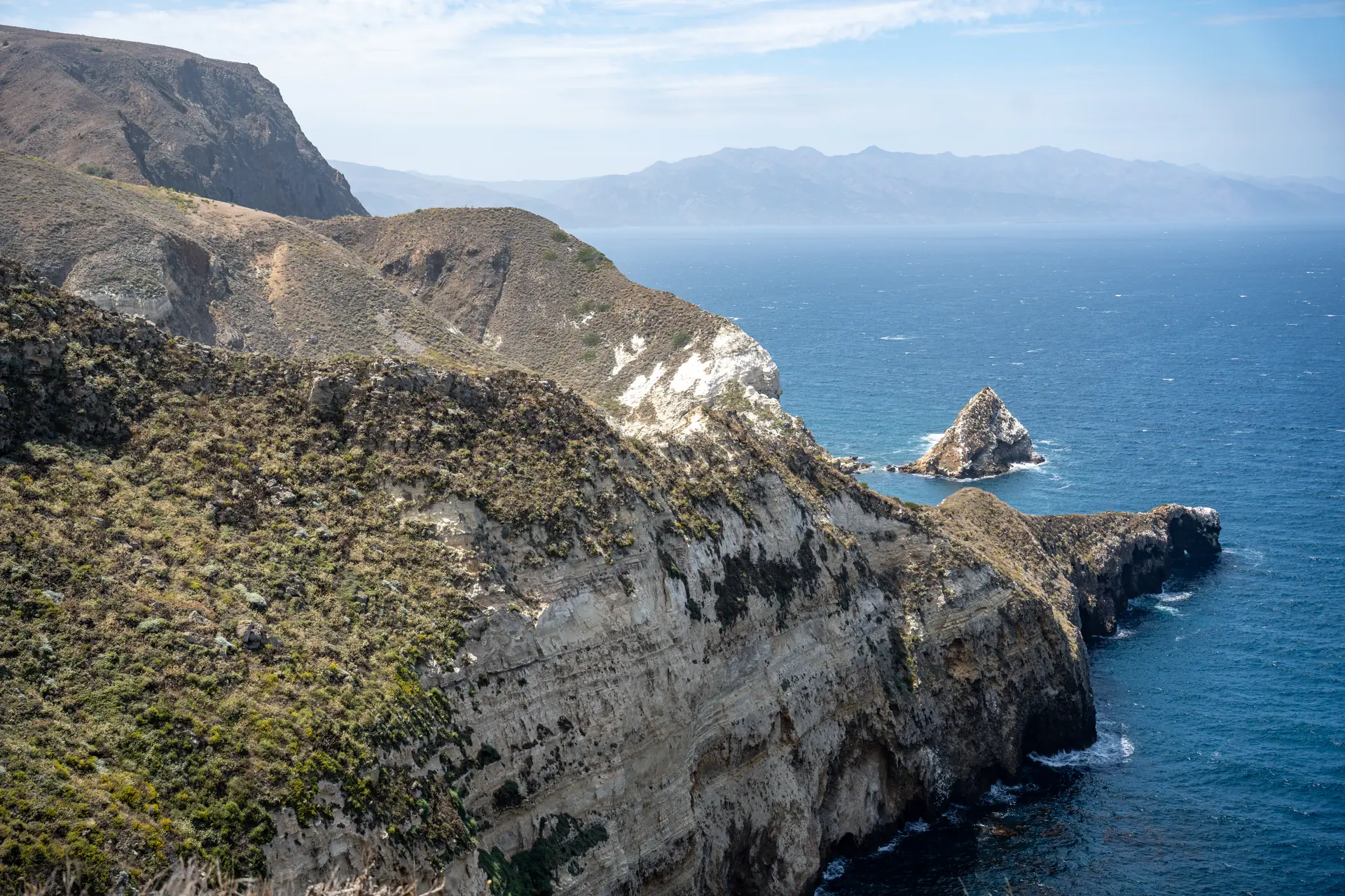
The Cavern Point loop is short but it earns its reputation immediately. You climb out of the canyon, the brush drops away, and suddenly you’re on a bluff looking down into water so clear you can pick out individual kelp stalks.
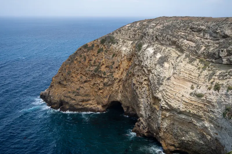 Sea Cave from Cavern Point Trail
The whole north shore is riddled with sea caves. The volcanic rock here fractures in ways that let the surf carve straight back into the cliffs, and Santa Cruz has one of the largest and deepest sea caves anywhere in the world, Painted Cave, over on the far end of the island. We only saw them from above, but even from up there you can hear the water working.
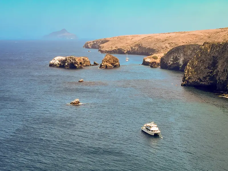 View of Scorpion Anchorrage from above
From Cavern Point we followed the North Bluff Trail west out to Potato Harbor, a narrow cove punched into the cliffs that you look down into from a few hundred feet up. No beach access, no way down.
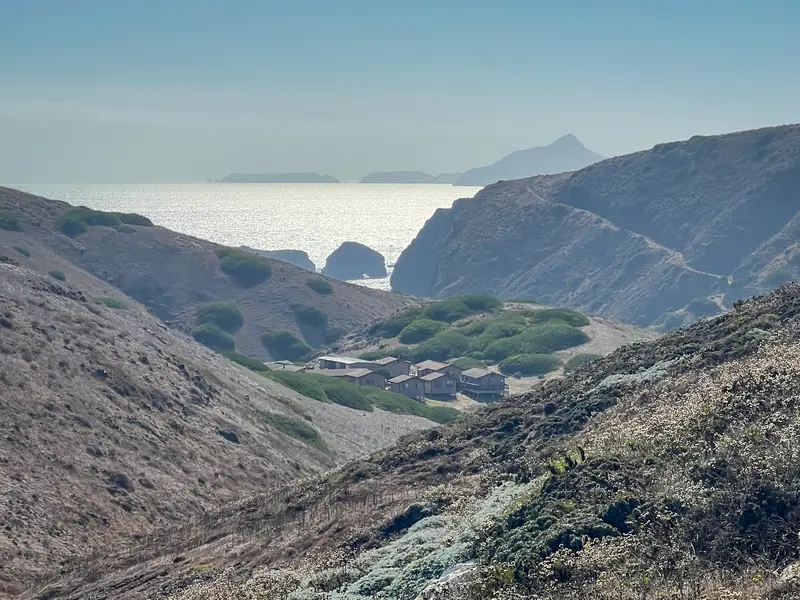 View of Scorpion Canyon from a trail
We came back around above the anchorage, then headed out the other direction toward Prisoner’s Harbor. We didn’t go all the way. Somewhere partway out we picked up the Montañon Ridge loop and took that back down to camp instead, which was the right call given we were already running on fumes.
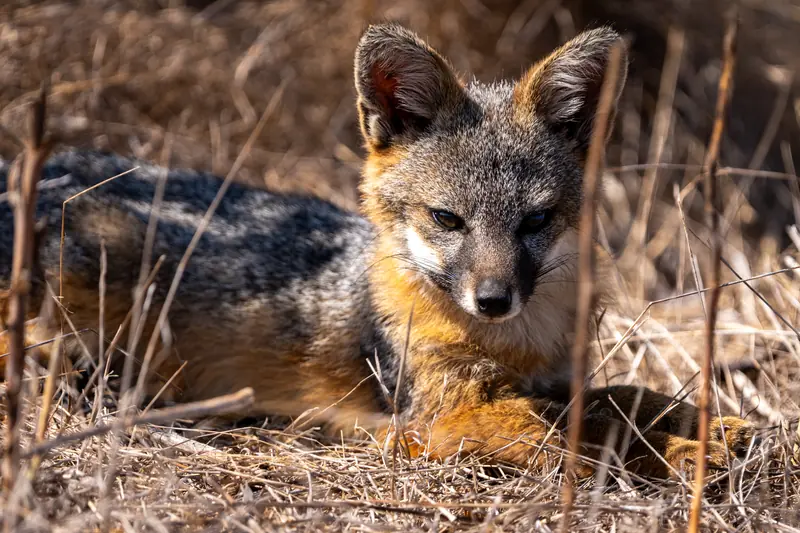 Island Fox
We saw one of these foxes along the trail and it did not care about us even a little.
The island fox is about the size of a house cat and lives nowhere on earth except these islands. Its story is one of the better conservation stories out there, and it’s grim before it’s good. Starting in the 1940s, chemical companies dumped DDT into the waters off Los Angeles for thirty years. Bald eagles ate contaminated fish, their eggshells thinned out, and by 1952 the birds were gone from the northern Channel Islands. Golden eagles moved into the empty territory, drawn by the thousands of feral pigs left over from the ranching days. Once the golden eagles settled in, they started taking foxes, which had never evolved any instinct to watch the sky.
The collapse was fast. On Santa Cruz the population fell to somewhere around 55 animals. On San Miguel and Santa Rosa it was fifteen foxes each.
So the park service, The Nature Conservancy, and the Institute for Wildlife Studies threw everything at it. Between 1999 and 2006 crews live-trapped 44 golden eagles and relocated them to the eastern Sierra. Contractors removed more than 5,000 feral pigs from Santa Cruz in 2005 and 2006. They released 61 bald eagles back onto the islands, bred foxes in captivity and put over 200 of them back in the wild, and vaccinated animals against distemper. In August 2016 three subspecies came off the endangered species list, the fastest recovery of any mammal ever listed under the Endangered Species Act. The 2024 count on Santa Cruz was 3,086 foxes.
We also spotted a Loggerhead Shrike on a bare branch, which was a first for me. Shrikes are songbirds that hunt like raptors but don’t have the feet for it, so they wedge their prey into thorns and barbed wire to hold it while they eat. Their genus name, Lanius, is Latin for butcher.
The Drum Circle
We crawled into the tent around 7:00pm, still a bit tired from the jet lag, and then lay there wide awake because a group next to us had started a drum circle, all singing in harmony. It was not what I expected to hear on a remote island. It echoed a bit off the canyon walls and had a slightly eerie quality to it.
It stopped around 9:00, and after that we slept hard. Through the night there were noises all around the tent. Rustling, some chittering, a few yips that did not sound like anything I could name. Foxes, probably.
Day Two and the Ride Back
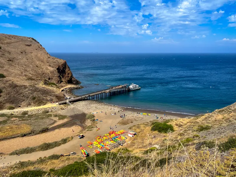 Scorpion Ranch Pier
We redid some of our favorite stretches the next morning, then spent the rest of the day poking around the ranch and the beach until the boat came at four. The crossing back was calm, which felt almost unfair after what we’d been through on the way out.
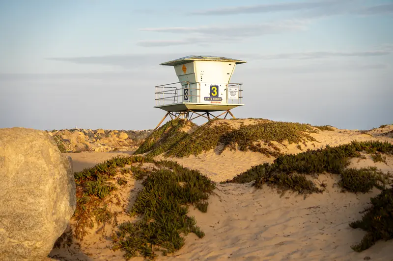 Beach at Ventura Harbor
We got dinner as soon as we were back on the mainland. Anything hot that we didn’t have to pour boiling water into felt like a luxury. Then we went to bed.
Hawkeye’s Front Yard
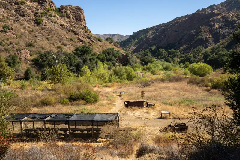 Mash filming location at Malibu Creek State Park
The next morning we drove down to Malibu Creek State Park, mostly for this.
20th Century Fox bought this land in 1946 after shooting How Green Was My Valley here in 1941, and called it Century Ranch. Over the next three decades more than a hundred films and TV shows were made on it. Butch Cassidy and the Sundance Kid did the cliff jump here, except the “river” was actually Century Lake and the whole shot was flipped and matte painted to hide the Santa Monica Mountains in the background. The original Planet of the Apes was largely filmed here in 1967, and we passed the old ape village site on the way in.
But the big one is MASH, which shot its exterior scenes at this spot from 1972 to 1983. The set was a real working camp with tents, vehicles, and a helicopter pad, and because it was so remote they ran it off generators, trucked in the water, and used outhouses. Alan Alda said the roughness of the location made the show feel more real. Fox sold the ranch to California in 1974 and the park opened to the public in 1976, so for a while the set was sitting on state park land while the show was still in production. Bob Hope donated most of the surrounding acreage.
The props sat out here rusting for years until a partial restoration in 2007 cleaned up the vehicles and added photo boards. It’s a little strange to stand in a quiet meadow and recognize the exact angle of a shot you’ve seen a hundred times, especially knowing the finale was watched by something like 106 million people.
We saw mule deer on the way out.
Santa Barbara
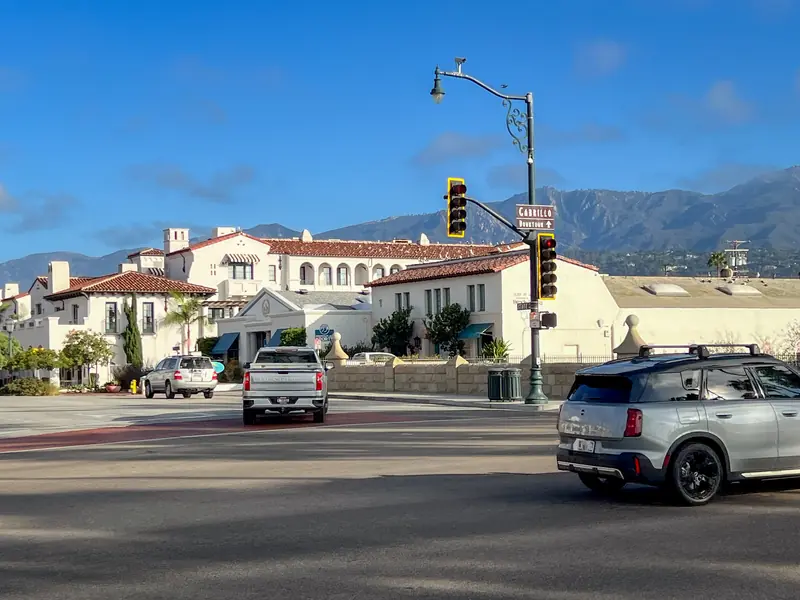 Santa Barbara intersection near Stearn’s Wharf
From Malibu Creek we drove up to Santa Barbara and checked into the Harbor View Inn, which is about as close to the wharf as you can get without sleeping on it. That was home for the rest of the week.
We spent the first evening walking the wharf and downtown. Stearns Wharf is the oldest working wooden wharf in California, built in 1872 by a lumberman named John Peck Stearns who was widely considered a fool for trying. One journalist at the time wrote that people assumed a wharf would never survive the waves and that anyone who funded it was throwing money into the sea. Colonel W. W. Hollister put up the financing anyway. Before the wharf existed, Santa Barbara was hemmed in by mountains on one side and surf on the other, and passengers and freight had to be rowed ashore through the breakers and the kelp. Stearns changed that overnight. His 2,300 foot pier became the longest deep-water pier between Los Angeles and San Francisco.
It has taken a beating since. In 1878 a Chinese junk was driven into it during a storm and destroyed a thousand feet of decking. It has burned three separate times, in 1921, 1973, and 1998. It was closed to commercial traffic during World War II. It’s still standing on wooden pilings.
Walking around downtown, we scouted places to eat and wrote down three: Rascal’s Mexican, Siam Street Food, and The Blue Owl. Then we called it a night.
One thing you notice immediately about Santa Barbara is how uniform the architecture is. Every building is white stucco and red tile. That’s not an accident and it’s not that old. On June 29, 1925 an earthquake leveled roughly thirty-six blocks of the business district. Almost nothing downtown escaped serious damage. Rather than rebuild in the mix of styles that had been there before, the Community Arts Association seized the moment and pushed to rebuild the entire city center in a single unified Spanish Colonial Revival style. So the “old” Santa Barbara you’re walking through is mostly a deliberate reconstruction from the late 1920s.
Birds, Bluffs, and a Very Small Mammoth
The next day we made a loop around the city.
We started at the Douglas Family Preserve, seventy acres of bluff-top open space on the Mesa. Locals still call it the Wilcox property, because Roy Wilcox ran a nursery here from 1949 until 1972 growing kentia palms. After it closed, developers lined up with plans for a luxury hotel, a subdivision, and a retirement community. Residents fought it for twenty years and raised more than two million dollars to help the Trust for Public Land buy the parcel for $3.6 million in 1996. The last piece came from Michael Douglas, a UCSB alum, who put in $600,000. That’s why it has his family’s name on it. You can still find old fire hydrants and curbs out in the brush from a subdivision that never happened.
Then we went to the Andrée Clark Bird Refuge, forty-two acres of salt marsh and brackish lake wedged between the freeway and the beach. The story behind the name is sadder than I expected. Andrée Clark died of meningitis in 1919, a week before her seventeenth birthday. Nine years later her younger sister Huguette, who would go on to become one of the most famously reclusive heiresses in American history, donated the money to create the refuge in her memory.
In the afternoon we went to the Santa Barbara Museum of Natural History. The highlight of this for me was seeing the Pygmy Mammoth.
Mammuthus exilis lived only on the Channel Islands. When sea levels were around three hundred feet lower, the four northern Channel Islands were joined into one landmass that geologists call Santarosae, and full-sized Columbian mammoths swam the gap to reach it. Columbian mammoths stood fourteen feet at the shoulder and weighed twenty thousand pounds. Cut off on an island with limited food and no predators, their descendants shrank to four and a half to seven feet tall and maybe two thousand pounds. They lasted until roughly 13,000 years ago.
The museum has two skeletons in the Earth Sciences hall. One is a composite that Phil Orr assembled from multiple animals back in 1959, the first pygmy mammoth ever mounted. The other came out of the ground in June 1994, when a geologist named Tom Rockwell spotted white bone poking out from under ice plant on the northeast side of Santa Rosa Island. It turned out to be around ninety percent complete, with the small bones still in life position, meaning the animal died right where it lay. It is still the most complete pygmy mammoth skeleton ever found anywhere.
Standing in front of all that Santa Rosa material was a little strange, because the island had been on fire a few months before we got there. On the evening of May 15 a 67-year-old sailor from Long Beach ran his 54-foot sailboat aground on the rocks at the southeast end of the island. The next morning he fired emergency flares to get the attention of passing boats, and something, either the burning wreck or the flares themselves, caught the grass. The Coast Guard airlifted him off uninjured. The fire burned for three weeks and took 18,379 acres with it, roughly a third of Santa Rosa, which makes it the largest wildfire ever recorded on any of the eight Channel Islands. It destroyed two historic structures, Johnson’s Lee Equipment Shed and the Wreck Line Camp Cabin. In a video the sailor shot of his own boat burning on the shoreline, you can hear him say he hopes he doesn’t set the island on fire.
We drove past the Old Mission but didn’t go inside. Founded on December 4, 1786 by Father Fermín Lasuén, tenth of the twenty-one California missions, and the only one that has stayed under Franciscan care continuously since the day it was founded. Three adobe churches stood on that spot before the current stone one, and an 1812 earthquake destroyed the third. The 1925 quake knocked a bell tower down.
Dinner was Rascal’s. It was very good.
Rattlesnake Canyon and a Hundred-Year-Old Garden
We drove up to Rattlesnake Canyon in the morning and hiked. The trail climbs through sandstone and chaparral in the front country of the Santa Ynez Mountains, the same Eocene rock that makes up all those pale cliffs above town. We didn’t see much wildlife. At one point we both stopped because of a dry buzzing sound in the brush off the trail. We didn’t investigate.
Later that day we went to the Santa Barbara Botanic Garden, which turns a hundred years old this year. In 1926 a group of prominent locals were picnicking in Mission Canyon when they noticed signs announcing the land was about to be subdivided. Within days Anna Dorinda Blaksley Bliss bought thirteen acres and endowed it as a memorial to her father, Henry Blaksley. It became the first botanic garden in the country dedicated entirely to native plants, arranged by plant community rather than by specimen. It’s grown to seventy-eight acres with more than five miles of trails and over a thousand California native species. Even redwoods.
We walked nearly all of it, which took a while. Part of what the founders wanted to protect was the Mission Dam, built by Chumash labor between 1806 and 1807 under Franciscan direction using local sandstone and mortar made from ground seashells. It carried water down to the mission. It’s still there inside the garden. There’s also an enormous sandstone boulder near the meadow that got where it is by riding a debris flow down the canyon about twelve thousand years ago.
We went back to Rascal’s for dinner. No regrets.
Lizard Mouth Rock, Waterfalls, and a Danish Town
Our last full day was the wandering one.
We drove up to Lizard Mouth Rock, out on West Camino Cielo along the crest of the range. The hike is almost nothing, maybe a quarter mile, but the terrain is a field of massive sandstone outcrops that wind and water have hollowed into caves and overhangs. We scrambled around on it for a while. From up there you can see over Goleta and the airport to the ocean, and on a clear day out to the Channel Islands themselves, which was a nice bookend to the week.
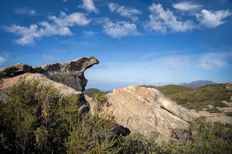 Lizard Mouth Rock Location
From there we drove out to Nojoqui Falls. The name comes from a Chumash village that stood nearby called Naxuwi, generally translated as “meadow,” and it’s pronounced roughly NAW-ho-wee. The walk in is about ten minutes through a shaded canyon. The falls drop around 164 feet.
What makes them unusual is that they’re growing outward instead of eating backward. Water seeping through the rock above picks up calcium and magnesium carbonate, and when it evaporates in the mist at the falls it leaves those minerals behind as travertine. It’s the same process that builds stalactites in a cave, just running down a cliff face. So the ledge at the top actually protrudes from the rest of the wall. The area around it is one of the rainiest spots in the county, and a spring keeps water coming most of the year. There’s a whole Chumash legend about a woman whose white dress became the waterfall and broke a drought.
Getting there took us through Solvang and past Cachuma Lake, and both looked interesting enough that we stopped on the way back.
Solvang is the sort of place you assume is a theme park until you read about it. Three Danish immigrants, two of them Lutheran ministers, went looking for a place to start a colony where their people could escape Midwestern winters. In January 1911 they bought nearly ten thousand acres of the old Rancho San Carlos de Jonata for around forty dollars an acre. They named it Solvang, “sunny field.” Forty settlers were there by the end of the year. They opened a folk school almost immediately, then a larger one in 1914 called Atterdag, which means “there shall be another day.”
The half-timbered gingerbread look came later. Bethania Lutheran Church in 1928 was the first building done in a traditional Danish style, and after a 1947 Saturday Evening Post article put the town on the national map, residents leaned all the way into it. Danish royalty has visited multiple times. Most residents today aren’t Danish at all.
We had lunch at the Peasant’s Feast and it was delicious.
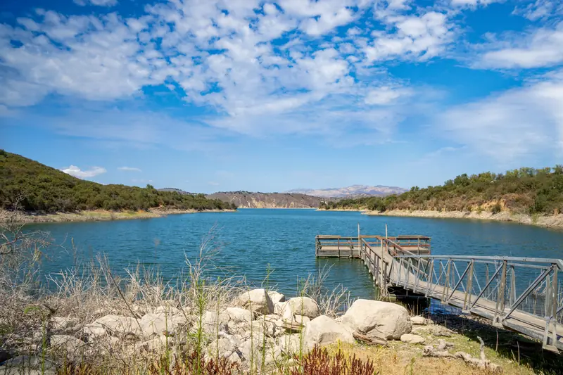 Cachuma Lake
Cachuma isn’t natural. Bradbury Dam went up in 1953, a 201 foot earth-fill structure built by the Bureau of Reclamation, and the reservoir behind it covers about 3,100 acres and supplies most of the South Coast’s water. The level swings hard with drought. The storms in late 2022 and early 2023 filled it to capacity for the first time in twelve years. We walked around the campground for a bit and enjoyed having the water in view.
Dinner that night was Siam Street Food back in Santa Barbara, and then we packed. We flew home the next day.
The thing that has stuck with me most isn’t a view. It’s how close all of this sits to the eighteen million people in greater Los Angeles, and how completely separate it feels the second the boat leaves the harbor. An hour of getting slammed around in a swell and you’re standing somewhere with no cars, no stores, no lights at night, and foxes that will walk past your boot without breaking stride.