Great Smoky Mountains National Park
Great Smoky Mountains National Park
We set out Friday morning for the long haul across the mountains, about six and a half hours of driving before we finally pulled into Cades Cove Campground. The Smokies have been on our list for a while, and there is something special about rolling into a park that sees more visitors than any other in the country. The Great Smoky Mountains National Park was officially established in 1934, and it took a massive fundraising effort to make it happen, including a $5 million donation from John D. Rockefeller Jr. that essentially saved the project. Unlike most parks out west that were carved from federal land, this one had to be assembled piece by piece from private holdings, and the Civilian Conservation Corps did much of the early trail and road work that we still use today.
After unpacking and setting up camp, we wanted to stretch our legs. We walked from our site up the road to the picnic area and picked up Anthony Creek Trail. The plan was to hike to the Russell Field Trail fork and turn around, which worked out to about five miles round trip. The trail climbs along a creek bed not far from the historic Cades Cove community, where European settlers had been farming and logging since around 1818. At its peak in 1850, the cove was home to nearly 700 people. When the park was established, those families were bought out and relocated, though a handful negotiated lifetime leases to stay on their land.
Back at the campsite, a small group of wild turkeys wandered through, completely unbothered by us. The tent-only loop was still closed for the season (it does not open until May), so we had to share the campground with the RV crowd. Sites were closer together than I would have liked and privacy was scarce, but after ten o’clock the place quieted down and I slept reasonably well. We had a freeze-dried meal for dinner and called it an early night.
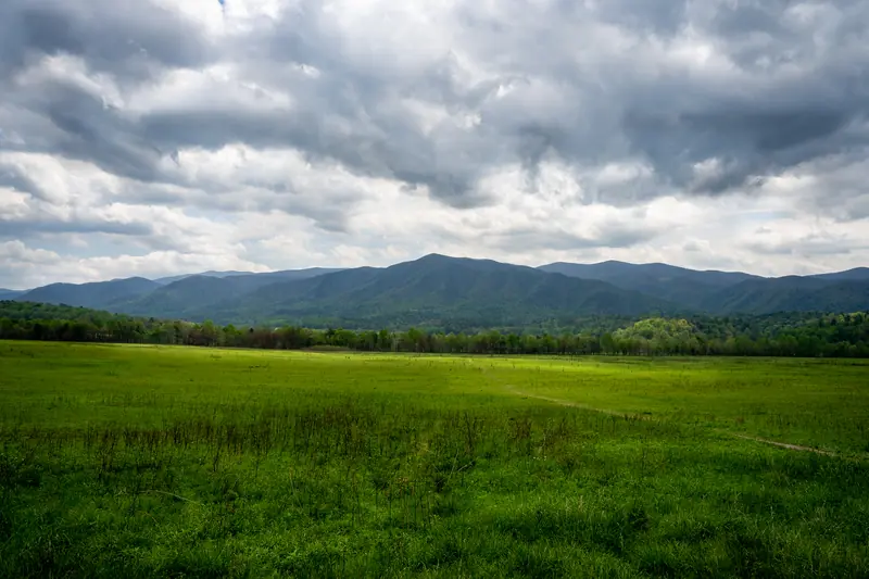 Scene from Cades Cove Loop
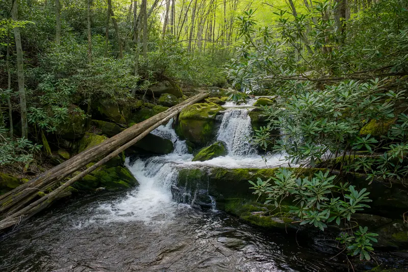
Middle Prong Trail
The next morning we ate some granola and drove about 30 minutes over to the Tremont area for the Middle Prong Trail. We arrived around 8:00 a.m. with the lot still mostly empty. This trail has a fascinating history. It follows the old roadbed of the Little River Lumber Company, which logged this watershed heavily from the early 1900s through the 1930s. You can still spot rusted railroad spikes and the occasional piece of old machinery if you look closely. The lumber company’s owner, Colonel W.B. Townsend, eventually sold his holdings to the park, and the railroad grades that he left behind became some of the most popular trails in the Smokies. The town of Townsend, which we drove through to get here, is named after him.
 Turkey on Middle Prong trail
We had not gone far when another turkey crossed the path in front of us, this one bigger than the ones at camp. Wild turkeys nearly disappeared from the Smokies in the early twentieth century due to overhunting and habitat loss, but they have rebounded dramatically thanks to reintroduction efforts and the protection of the park.
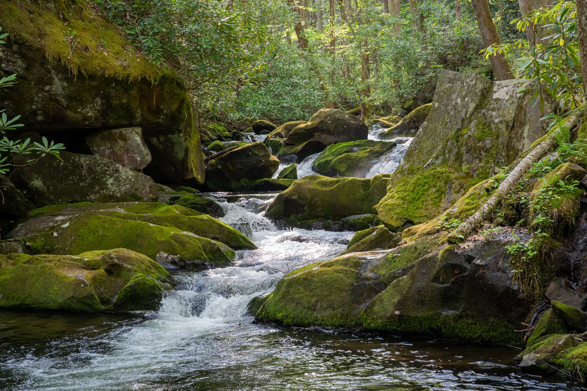
The whole trail follows the creek up the mountain, with cascades and pools at almost every turn. There are several spots where the water tumbles over moss-covered rocks into clear pools, and we stopped a few times just to watch the water.
 Mini Falls along the Middle Prong trail
 More Mini Falls Along the Middle Prong Trail
 More Mini Falls on the Middle Prong Trail
The other thing we noticed right away was butterflies. There were hundreds of them, gathered in clusters on the wet sand and gravel along the creek. This behavior is called “puddling,” and it is mostly the males drinking up minerals like sodium that they cannot get from nectar alone. They pass these nutrients along during mating, which apparently improves the survival rate of the next generation. We saw two main species doing this in big groups.
 Puddle of Pipevine Swallowtails
The dark blue ones are Pipevine Swallowtails. Their caterpillars feed exclusively on pipevine plants, which contain toxic compounds called aristolochic acids. The butterflies retain those compounds into adulthood, making them unpalatable to predators. Several other butterfly species mimic their coloring just to get the protective benefit without the toxicity.
 Puddle of Eastern Tiger Swallowtails
The bright yellow ones are Eastern Tiger Swallowtails. They happen to be the state butterfly of five different states, including North Carolina, Georgia, and Virginia.
We finally reached Indian Flat Falls, a multi-tiered cascade tucked into a side draw about four miles up the trail. We sat on the rocks and ate a granola bar. On the scramble down to get a better look at the lower tier, we slipped on some wet stones, but luckily nothing was hurt except our pride.
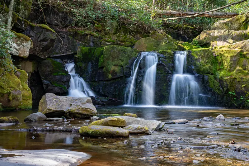 Indian Flat Falls
We took a few pictures and started back down. The return hike always seems to go faster, and we were at the trailhead before we expected.
Bear Jam on the Cades Cove Loop
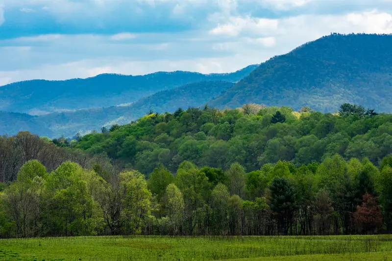
After the hike we figured we would head over to the Cades Cove visitor center for a bite to eat. To get there you have to drive the famous 11-mile one-way loop road, which winds through the historic cove past preserved cabins, three pioneer churches, and the John P. Cable Grist Mill (built in 1868 and still operational today). The loop is one of the most popular drives in the entire park system, and it shows. Traffic was crawling, then it stopped completely a couple of miles short of the visitor center.
 Another Scene from Cades Cove Loop
It turned out to be a “bear jam,” which is exactly what it sounds like. We counted eight black bears in all, scattered across the meadow and the surrounding trees. The Smokies have one of the densest black bear populations in the eastern United States, with roughly 1,500 bears living in the park, or about two per square mile. One of them had climbed about thirty feet up and was sound asleep on a branch, which is apparently more common than you would think. Black bears in the Smokies climb trees to escape threats, find food, and yes, to take a nap.
 Black Bear Sleeping in a Tree
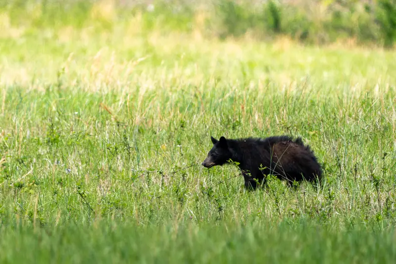 Black Bear in the Field
By the time the traffic finally moved we were too far behind schedule to bother with the visitor center, so we just rolled back to camp and called it a day.
The Drive Back
The next morning we packed up and headed back along the parkway. We stopped at a few overlooks to take pictures of the layered ridges fading into the distance. The “smoke” the mountains are named for is actually a natural fog created when the dense forest releases volatile organic compounds, which scatter blue light and give the ridges that hazy look. The Cherokee called these mountains Shaconage, which translates roughly to “place of blue smoke,” long before any European settlers arrived. Standing at one of those pull-offs and looking out at the haze, it is easy to see how the name stuck.
Three days felt short, but the Smokies have a way of making you slow down. Already thinking about coming back next year.